Distance: 5 km. Elevation: 214 m. Difficulty: Easy to Medium.
For this Harting Down 5 km walk you need Ordnance Survey Explorer 11. If you deviate off the route via Beacon Hill, this route has an impressive elevation of 214 metres.

Harting Down is a National Trust area of chalk downland nature reserve and Site of Scientific Interest in the west of West Sussex through which runs a stretch of the South Downs Way. There’s a steep drive up to the car park from where you can start a number of different walks.

Up the Downs
From the car park, immediately pick up the South Downs Way and head “up”! Like so much of Sussex, this part of the South Downs Way has been undulating along under the feet of weary travellers since the Iron Age and it’s all about the view north. I walked it on a summer morning (I know, it doesn’t look like summer), and yet even then, there were few people about and the only sound was that of the tiny sheep far below and the wind. Look back the way you’ve come and you’ll see the mysterious-looking ruins of the Vandalian Tower on the opposite ridge in the distance. More of that in a moment.

Follow the path, up and down various dykes until you reach a small valley with a signpost set in a stone mount. Ahead is a (literally) breathtakingly steep climb up Beacon Hill. Your actual route is right here, sticking to the South Downs Way along a valley called Bramshott Bottom but, it’s worth a short (if painful) deviation up Beacon Hill just for the views. This is the site of an Iron Age Hill Fort and it’s not hard to see why they chose such a strategic position.

There’s a lot of bottoms in these parts and from Beacon Hill you may find yourself making your way up Granny’s Bottom or Whitscombe Bottom depending on the way you decide to head back.
For my part, I retraced my steps very carefully back down Beacon Hill and continued along the South Downs Way until I reached Little Round Down where I turned right. It’s fair to say that from Beacon Hill back via my circuitous route to the car park I didn’t meet a single soul and it felt very much like Lorna Dune country, wild and undiscovered. As I dropped down into a little valley, the way home was via Kill Devil Copse, a dark and mysterious wood, with ancient and twisting yew trees. I hurried on through, following the path until a right turn which took me through a field parallel to the road and back to the car park.

The Vandalian Tower
If curiosity has got the better of you, on the opposite side of the road from the car park, you can follow the footpath up to the Vandalian Tower. You can get quite close but it is fenced off from the public. It forms part of the Uppark estate and was built to commemorate a scheme in which Uppark’s owner Sir Matthew Fetherstonhaugh intended to exploit a territory in West Virginia which was to be called Vandalia. Having been designed and built in 1770 on Tower Hill, the highest point in the estate, unfortunately, Sir Matthew died in 1774, and the Vandalian venture collapsed.

There are also rumours that the tower was the meeting point for a notorious group of youths called The Hellfire Club. The sort of stuff normally thought up in a TV drama, Hellfire clubs were an 18th century phenomenon, whereby high-society rakes or “persons of quality” took part in “socially perceived immoral acts”, often including politics. Apparently, neither the activities nor membership of the club were easy to ascertain, so what they got up to here is left to your imagination.
The tower was partly destroyed by fire in 1842 and only the ruins are now visible.
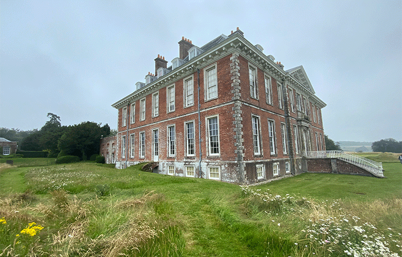
If you’re visiting Harting Down, Uppark (also National Trust) is just a 5-minute drive away and well worth a visit.
If you like this West Sussex Walk along Harting Down, and our in the area, you may also like:
A Visit To Historic Uppark
West Sussex Walks: Ancient Black Down
11 Things to Do in Midhurst


